Wednesday, April 10, 2013

Breathtaking Puerto Escondido


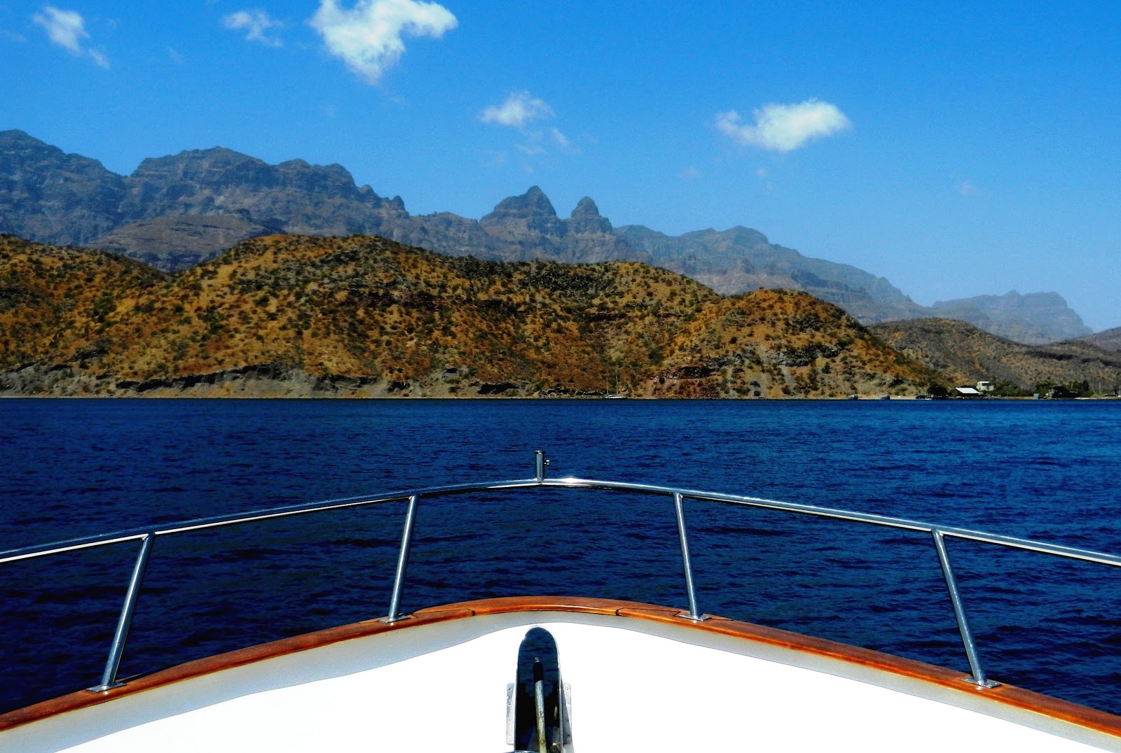
Approaching Puerto Escondido
We left Santa Rosalia on a blustery day with strong winds predicted for the next several days over the northern reaches of Baja.  We headed south, passing Punta Chivato with 5-6 foot seas hitting us broadside as we rounded the point. 

One of Several Mooring Areas with Buoys
Looking through the binoculars, we could see the small dirt runway where we landed with our small plane so many years ago; the area has grown but the runway and small resort look much the same.  We recalled our plane loaded with two adults and two young boys, and the challenge of taking off at Punta Chivato.  Aware that it takes longer to ascend on hot days with a full load, we taxied down one of the two runways to confirm its distance and condition – the runway was shorter than expected with a rise in the approach and mountains at the far end.  The runway seemed the appropriate choice for the wind direction but was far too short; if we had taken off, we surely would have found ourselves in the side of a mountain.  We wisely chose the other runway even though there was a strong crosswind, best to have a long enough runway!  Our thoughts soon drifted back to Got d’ Fever and we continued our 12-hour journey to Isla Coronados, anchoring in the lee of the island at dark. 


Cactus, Mangroves, and Turquoise Waters
As is the routine, we had saved the route from our previous visit to Coronados, enabling us to simply follow the route on our chart-plotter into the bay at night.  Setting the anchor in the dark was a little tricky but doable with lights shining on the foredeck.  Next morning we departed for Puerto Escondido, a short 2-hour journey and tied-up to one of the many mooring balls in the harbor.  
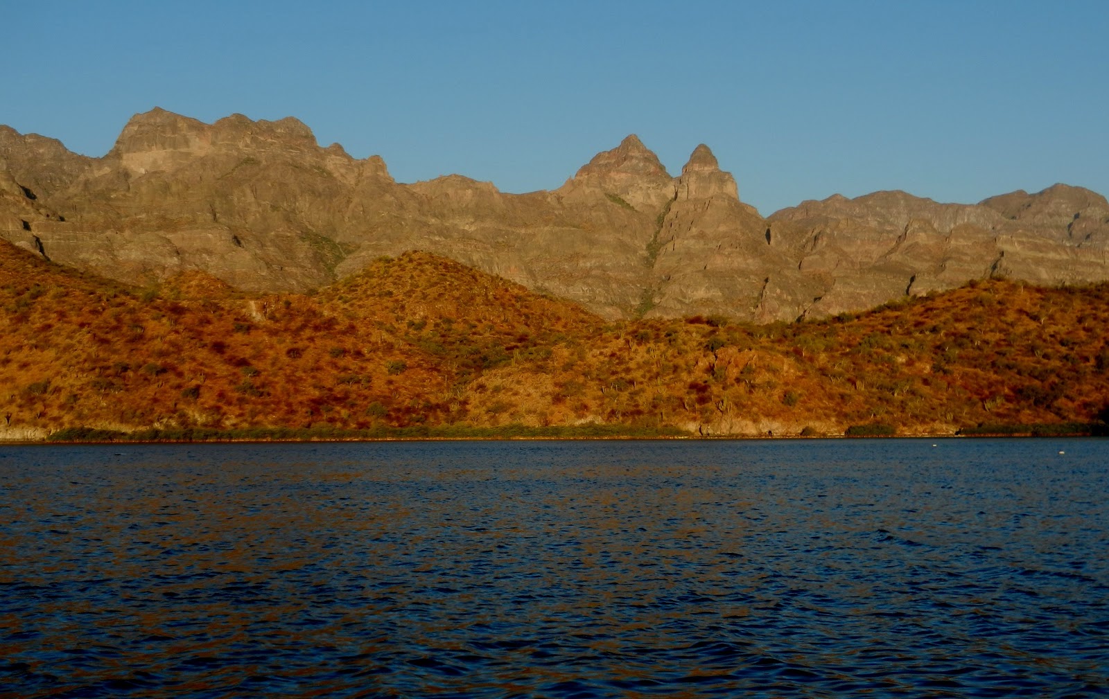
Morning Light on the Sierra Giganta Range
Puerto Escondido must surely be the most spectacular moorage spots in all of Baja.  The cathedral-like Sierra de la Giganta Mountain Range rises steeply above the harbor, hillsides are covered with handsome cactus, and the turquoise waters are lined with mangroves - a combination of unsurpassed beauty.  
Cathedral-like Mountains Bathed in Morning Light
Boaters visiting the area have the option of docking at the government run Fonatur Marina, or can choose from numerous mooring balls located in three different areas of the harbor.  The marina recently expanded its facilities, adding more docks and moorage slips within the last few months.  Building lots, streets, and curbs previously put on hold are once again under construction.  With the breathtaking scenery and the lovely town of Loreto a short commute away, it’s no wonder folks are thinking about moving here in the not too distant future.
New Docks at Fonatur Marina, Escondido


Marina with Mooring Buoys in distance

Monday, April 8, 2013

The Boleo Copper Mine


Steam Derrick
Ruins of Copper Processing Plant
Santa Rosalia was originally founded in 1705 but the town failed to prosper because of repeated epidemics and disastrous floods affecting farmlands.  A chance find of copper-bearing ore changed its fate.  In 1885 a new lease on life was granted by the El Boleo mining company backed by French capital.  President Diaz of Mexico granted the company a 99-year concession to begin mining for copper in exchange for building the necessary infrastructure:  a port, railway, town, and foundry.  The world market for copper was taking off so it proved to be good timing; a rising demand for the metal was coming from electric companies in Europe and the USA.  Within a decade the mining company had become responsible for more than 80 percent of Mexico’s export of copper ingots and recognized as a major world copper producer.  Square-rigged vessels, flying the British, US, or German flag were constantly arriving in the harbor.  We were fascinated to learn that smelted ore was shipped to Washington State to be refined and ships would return with loads of lumber and other supplies for Santa Rosalia. 


Malecon - Old Smelter Plant in distance
Workers flocked to this little town in Baja from around the world, including three thousand from China.  Working conditions were atrocious and health conditions for the miners and foundry workers were appalling, causing many deaths.  To help alleviate the problem the company decided to move the smelter chimney rather than move the workers’ homes.  The new chimney was built about a mile out of town, connected to the smelter by a large, ground-hugging flue.  The flue can still be seen today on a hill above Hotel Frances.  Copper deposits thinned in the 1920’s, but El Boleo continued mining until 1953.  The State-run “Compania Minera Santa Rosalia” continued to mine the claim until 1985, at which time the smelter was finally shut down on the eve of the town’s 100th anniversary.  


Historic Boleo Office Building & Museum
The original office buildings, homes, and hotel of the early period still stand on the hill overlooking the old processing plant and harbor.  The office building constructed sometime between 1885 and 1900 now serves as a museum.  The interior of the building has been left intact and the furniture is also original.  Of interest is the telephone system that functioned with dry cell batteries.  The switchboard and lines were for the exclusive use of the company and served as communication between the mines and the different offices.  Today the executive houses are occupied by residents or serve as government offices, while the old company hotel continues to welcome guests.  
Insulators for Telephone Lines on Office Building
The hotel was built in 1886 and provided all the services required for those single employees, French and Mexican of certain social standing.  Surprisingly, Santa Rosalia has just begun a new era focused on mining.  The massive El Boleo copper cobalt zinc-manganese deposit, which fueled the town’s first boom period, is now being re-developed with new technology.  Baja Mining based in Canada owns 70 percent of El Boleo with a consortium of Korean companies owing the remaining 30 percent.  During its anticipated 23-year life span, El Boleo is expected to yield more than 2,000 metric tons of cobalt, 25,000 tons of zinc sulfate, and 50,000 tons of copper annually plus provide over 3,000 jobs to the local economy.  
Boleo Office Building Overlooks the Harbor
We could clearly see evidence that Santa Rosalia is a busy working town, cars line the streets and people are constantly coming and going throughout the day.  At the waterfront next to the old plant, we saw workers taking the bus, undoubtedly to the new site camp and earthworks.  
Two-story Office Building Entrance Hallway
These new workers are following in the footsteps of those who have gone before, but thankfully with improved environmental standards, work conditions, and new technology that have brought about the revitalized copper production in Santa Rosalia, begun in early 2013.
Desk Stations


Original Furnishings Throughout


Boleo Company Town

Hotel Frances


Chimney and Ground-hugging Flue above Hotel Frances

Saturday, April 6, 2013

Unique Character of Santa Rosalia

 
Old Town Santa Rosalia
Buildings in Mexico are most often made of concrete mainly due to the limited supply of wood and because concrete helps maintain cool temperatures while deterring pests.  Santa Rosalia began as a company town for a French copper mining business so “old town” has predominately wood-framed buildings of the period.  Santa Rosalia oozes with the character of the past; many buildings left from the late 1800’s and early 1900’s are still used as homes, shops, restaurants, and hotels. 

Santa Rosalia has a Special Character
Old locomotives and mining equipment from the early days can be seen throughout town, and ruins of the copper smelter operation stand silent along the shore.  In 1868 Jose Rosas Villavicencio found ore in the shape of blue-green spheres (boleos) and had them shipped across the gulf to Guaymas to be analyzed. 


Many Photo Opportunities in Santa Rosalia
A small scale prospecting enterprise soon began but the discovery was eventually seen by a French geologist from the House of Rothschild, which purchased all the smaller mine claims in 1885.  The Boleo Mining Company was formed and constructed a network of roads, ranches, farms and water lines to supply the needs of the mine and miners.  
Buildings From the late 1800's and early 1900's in Santa Rosalia
One important asset for the town however was over-looked, the need for a church.  Alexander Gustave Eiffel (of Eiffel Tower fame) had designed a prefabricated metal church in 1884 as a prototype for missionary churches in France’s tropical colonies.  Built in 1887 to be strong enough to withstand severe tropical weather, the church was made from galvanized iron with stamped steel sheet squares for the exterior and interior.  In 1889 the church and the Eiffel Tower were put on display at the Paris World’s Exposition.  Years later, an official for the French Boleo Mining Company learned that the church was being stored in a Brussels warehouse.  He purchased it and had the church shipped to Santa Rosalia where it was reassembled in 1897.  The church has since been modified to hold more parishioners but the main church edifice is preserved in its original state.


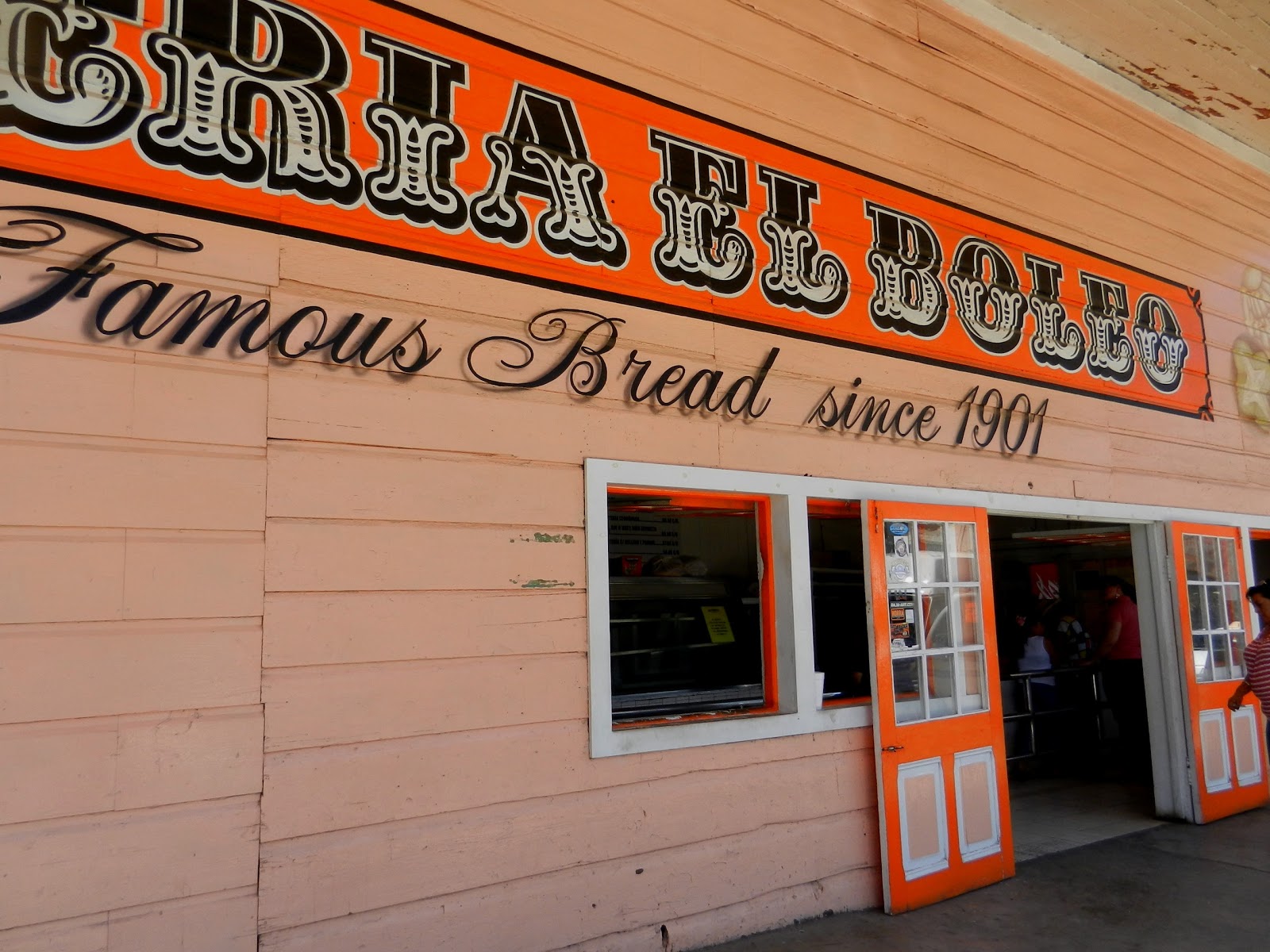
The Panaderia
Parish Church at Santa Rosalia
Baptismal Day of the Parish

 Steel Stamped Sheets and Rib Supports


Beautiful Stained Glass Windows

Wednesday, April 3, 2013

Bahia Concepcion


Approaching Punta Pulpito
With thoughts of the Cruisers Shrine left behind, we departed Caleta de San Juanico at noon and headed for Bahia Concepcion.  As we rounded Punta Pulpito, we found ourselves bucking into 30 knot winds.  We estimated our arrival at Bahia Concepcion would occur in the dark around 6:30pm.  That didn’t sound like a good idea; Bahia Concepcion is challenging enough to enter during the day, let alone trying to navigate the entrance at night and locate suitable anchorage. 

Punta Pulpito
The voice on the shoulder said to “do an about-face and anchor behind Punta Pulpito for the night; you can take your time tomorrow.”  We set the anchor and enjoyed the impressive headland of Pulpito with its distinctive vein of obsidian hinting at the area’s volcanic history. 


Vein of Obsidian
The vertical vein clearly showed that this was a lava flow which had cooled rapidly, resulting in the glass-like rock material called obsidian.  As anticipated, the seas were much better the following morning and we continued our six-hour journey to Bahia Concepcion, encountering a variety of wind and wave conditions.  After rounding Point Concepcion, our attention was focused on avoiding the shoals and rocks that line the entrance to the Bay.  Aptly named, Bahia Concepcion is a 24-mile long bay with a shallow, narrow choke-point inside the entrance, like a birth canal.  Once through the canal and into deeper water, we had several protected anchorages from which to choose.  
Punta Concepcion
The main anchorage areas in Bahia Concepcion include Bahia Coyote about mid-way, and Isla Requeson located further south.  We chose Bahia Coyote which includes several smaller coves and anchored off Playa Santispac.  We used this anchorage as our home base to explore the other coves called Posada Concepcion, Playa El Coco, and Playa El Burro which are all within Bahia Coyote.  The scenery is quite picturesque with vacation homes and fishing cabins nestled in the coves, backed by impressive high mountains.  Hwy 1 runs along this portion of Bahia Concepcion so there is easy access for motor-homes and campers; we saw several motor-homes parked at Playa Santispac.

Vacation Homes at Posada Concepcion


Vacation Homes at Playa El Coco

Fishing Cabins at Playa El Burro

Monday, April 1, 2013

A Cruisers’ Shrine


Entering Caleta de San Juanico
We arrived April 1st at Caleta de San Juanico on the Baja Peninsula.  We ducked into this large cove, escaping the 18 knot winds and found ten other boats already anchored in the bay. 


Numerous Sea Stacks at Caleta de San Juanico
Not only does the cove provide shelter from northwest winds, but it’s a popular stop for the interesting rock formations, numerous sea stacks, and multiple sandy beaches.  San Juanico is also known as the place chosen for boaters to leave a memento of one’s journey to Baja California.  As we prepared the dinghy to go ashore, Java made it quite clear that she wanted to go too.  With her hind legs on the swim step of the boat and her front paws on the edge of the dinghy, she soon found herself stretched over the water.  Taking the leap of faith, she landed safely inside the launch, whew! 


Java Climbing aboard the Dinghy
We motored away and soon spotted the Cruiser’s Shrine along the shore - a tree decorated with an assortment of materials that spell out various names of boats that have gone before us.  We chose a spot in the tree and hung our colorful beanpod, painted with flowers and our boat name, Got d’ Fever.  It was the perfect item for the occasion, a token previously given to us by Paradise Village Marina.  After hanging our memento, we stood and admired all the creative contributions to the tree:  signs with letters shaped out of rope and line; netting with embroidered lettering; names created with shells and stones; names carved in wood and etched in rock; there was even a message in a bottle.  
Gone Ashore to Visit the Cruisers Shrine
We soon had the realization that Got d’ Fever is now immortalized in both Baja and north British Columbia.  After our pregnant pause, we headed off to a sandy beach where Java got to run and play; “it’s about time,” she must have thought.  After cooling off in the water, we continued our tour around the bay, exploring its many nooks and crannies, rock formations, and sparse plant life.

Hanging a Memento on the Cruisers' Tree Shrine
Our Memento for Baja
Interesting Rock Formations

Distinctive Rock Strata and Giant Cardon Cactus

Sunday, March 31, 2013

Volcanic Island of Coronados


Lovely Town of Loreto - beautiful mountain and tree setting

Before reaching the volcanic island of Coronados, we stopped off at Loreto on our way north to pick up some groceries.  Unfortunately, Loreto doesn’t have a harbor for boats other than pangas so we anchored offshore and took the dinghy in for supplies. 


The Outskirts of Loreto
The local children love to watch your dinghy for a small fee or help with your lines and load your groceries at departure.  We encountered a group of very enthusiastic boys who each wanted desperately to earn their own dinero.  We engaged their services and they left with big smiles, anticipating future business deals to come.  It was great fun to revisit the charming town of Loreto.  Like La Paz, Loreto has a lovely malecon and a tight-knit community spirit.  The town square, streets, and beaches were full of people celebrating the Easter weekend, spending quality time with their families.  In addition to the lovely malecon, historic buildings and church mission, Loreto has one of the prettiest town squares and many fine cafes.  It is not surprising that Loreto has become a popular vacation destination and home to many expatriates from Canada and the U.S.  As fortune would have it, a couple from Kirkland stopped by to say hello; they had noticed the name of our homeport printed on the stern of our boat.  We had a long chat and learned that they have a home in Loreto where they live most of the year. 


Newly Extended Malecon at Loreto
After picking up groceries at Loreto, it was back to the boat for a short cruise to the nearby island of Coronados.  
Whale Shark Sculpture; Isla Coronados in Backgound
This cone-shaped island with its turquoise colored waters and beautiful soft sandy beach is another favorite National Park.  A well maintained trail leads partway up the island, about a six mile round-trip hike.  Steep, rocky cliff-sides surround the old volcanic cone (928 feet), while the southern portion of the island is long and low.  We walked part of the park trail and came across various plants, birds, and even a nasty looking snake.  The snake was lying right in the middle of the trail as if waiting for us; I made a careful detour and the snake slithered off into the bushes, creating a zinging sound over the sand covered terrain.  The next day, Coronados was still calling to us.  We took the kayaks into shore and hiked to the end of the trail, this time wearing our boots so as not to get bitten by any creepy-crawlers.  We didn't see any snakes that day but we did come upon a nest of yellow-jackets near the trail.  We reached a field of rocks partway up the mountain; fortunately stacked rocks (cairns), marked the way.  As we made our scramble over the rocks, we could hear what sounded like glass breaking under our feet; pieces of beautiful obsidian lay scattered throughout the rock field.  We soon discovered lizards were crawling under all that rock!  One fat, colorful lizard crossed right in front of me; not wanting to have his picture taken he quickly dashed down a big hole in the rocks.

Isla Coronados


Hiking the Sandy Trail on Isla Coronados


One of Several Beaches at Isla Coronados

A Cairn Marking The Way

Partway up Isla Coronados


The Ominous Looking Black Snake
Palo Adan Thorn Bush

Torote Blanco Tree


Got d' Fever Anchored off Isla Coronados