Wednesday, June 26, 2013

Southern Reaches of San Francisco Bay


Ghost Marina now a Wetland Habitat

Today we bicycled along the levees at the Alviso Marina County Park, a wildlife refuge for migratory birds located at the extreme southern end of the San Francisco Bay.  The Guadalupe River and Coyote Creek terminate at Alviso, emptying into the Bay through Alviso Sough and Mud Slough which are protected by levees.  


Alviso Slough leading to Coyote Creek and San Francisco Bay - Navigable by Dinghy
Clapper Rail at home in Alviso Wetlands
Originally called the Embarcadero de Santa Clara de Asis, Alviso supported the trade from Mission Santa Clara and the tiny community of San Jose (not much more than a dozen or so mud huts), in addition to the ranchos that bordered on the Bay.  Beaver pelts, cattle hides, and tallow were sent to San Francisco by boat from Alviso.  Later mercury from the New Almaden mines (opened in 1845) was shipped through Alviso and several years later, traffic increased considerably to support the Gold Rush.  


Biking the Levees
The town was incorporated in 1852 by which time it was a lively community of homes, bars, hotels, and stores and had become an important shipping port.  Steamboats traveled regularly from Alviso to San Francisco carrying barrels of flour produced from wheat grown in nearby Santa Clara Valley.  As wheat production in the San Joaquin Valley grew, production in the Santa Clara Valley waned and the Alviso Mills closed in 1885.  
A Peaceful, Quiet Bike Ride
In 1906, Thomas Foon Chew opened the Bayside Canning Company in Alviso, taking over the Precita Canning Company from his father.  Chew grew the business into California’s third largest cannery and at its peak, employed hundreds of Chinese workers who were lodged in company houses near the factory.  During The Depression, Alviso was known for its dance halls and gambling establishments; during the same period, the death of Chew in 1931 brought the cannery to an end.  
A Passenger Train passes through The Wetlands
A Scenic Rail-line
The port also waned as the railroad took over the shipping of goods, resulting in the dramatic decline of Alviso.  By the turn of the century, little was left of the once bustling shipping trade.  
Old Alviso Railroad Station, now a Home
Only the smallest of pleasure boats, dinghies, and kayaks are now able to navigate the slough into Alviso at high tide.  A marina for pleasure boats was built in 1965 but the required dredging to keep it open was stopped in the 1970’s due to environmental reasons.  Silt has since filled over the docks and only the gates are visible above the reeds; however, a boat ramp is maintained for launching small watercraft for recreational purposes.  Alviso’s identity has shifted to its new role as a managed wetland.  The South Bay area provides critical habitat for birds and contributes to the environmental health of the Bay.  Twenty-five square miles of former commercial salt ponds in the South Bay, now publicly owned, are being restored to tidal wetlands for migratory birds and other wildlife.


Ruins of the Bayside Canning Company
Laine Store (1865-1912) and Chinese Gambling Hall (1920's)
Tilden-Laine House (last Victorian home on Elizabeth St.)
South San Francisco Bay Regional Map

Wednesday, June 12, 2013

Almaden Quicksilver


El Casa Grande
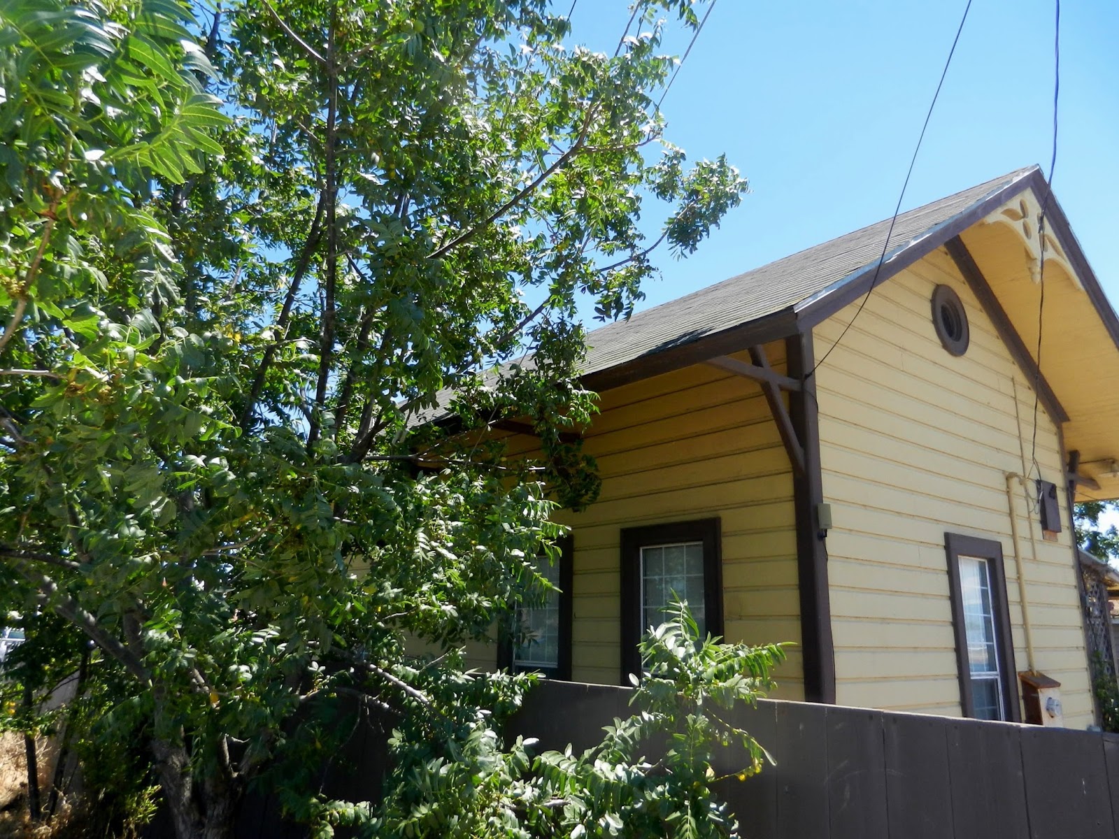
While moored at Brisbane Marina, we rented a car and drove to the town of New Almaden to visit El Casa Grande.  This grand house, once a residence for a succession of mine managers and their families, is now the home of the New Almaden Quicksilver Mining Museum.  Dedicated to the history, geology, and mining communities of New Almaden, the museum provides a glimpse of life in Santa Clara County 150 years ago. 


Beautiful Rooms in the Casa
Rooms of the home display period furniture and artifacts of daily living, while another portion of the home depicts the region’s mining history through photographs taken by a doctor who witnessed one of the world’s largest mercury-mining operations of its time.  Mining operations in New Almaden first began in 1845 under the claim of Mexican Cavalry officer Captain Andres Castillero.  Castillero discovered that the red rock was cinnabar, an ore containing mercury.  Considered a valuable commodity, mercury was needed to process silver in Mexican silver mines and later to process gold discovered in California.  Mercury, also called “quicksilver” is still used in levels, thermometers, lamps, barometers, batteries, electronics, medicine, and agriculture.  
Cinnabar
The red rock harvested from the hills of New Almaden spawned a thriving economy and several settlements in the area.  American companies eventually acquired ownership of the mines, where operations continued under the management of Captain Henry Halleck.  Halleck had the Casa Grande designed and built in 1854, which served as the official residence and office of a succession of mine superintendents for several decades and was also used as a weekend retreat for wealthy mine investors. 
Efficient Processing with Furnaces
The earliest processing of cinnabar ore at New Almaden was done by heating the ore in huge metal “whale pots” to extract the mercury, a crude but effective method due to the richness of the ore (sometimes more than 60 percent mercury).  After the richest ore was depleted, the ore had to be roasted to recover the same amount of mercury from far greater quantities of low-grade ore.  Small batches of mercury could be extracted by using a retort, a device similar to a moonshiner’s still.  Large furnaces and condensers improved and evolved so more mercury could be recovered from each ton of ore; however, the furnaces had to be cooled periodically and cleaned out before starting another batch – a time-consuming, labor intensive process.  An experimental furnace, constructed at New Almaden in 1874, revolutionized ore processing.  This new reduction process allowed ore to slowly trickle into the top of the furnace.  Gravity then brought the ore slowly down a vertical shaft and out the bottom while its mercury content was vaporized, condensed, and collected.  
Filling Iron Flasks with Mercury
During the late 1870’s, New Almaden produced more mercury than any other mine in the world.  The New Almaden Mine produced 83,974,076 pounds of mercury until the operations ceased in 1976.  Long after innovative methods of processing ore became available, miners at New Almaden continued to use primitive methods to obtain the ore – blasting with black powder and drilling holes by hand with one-inch steel bits.  More than 50 miles of tunnels honeycomb the hills of New Almaden, nearly all were built by hand.  
Cinnabar Ore Mine Shaft
Stacks of Wood Beams used for the Tunnels 
The mine property and the Casa Grande make up the Almaden Quicksilver County Park with miles of trails, remnants from the past, and informative plaques describing the communities of Mexican, English, and Chinese miners and their families.
Cinnabar Paste Used for Design


Red Dots show Cinnabar located around the World 

Thursday, June 6, 2013

The Human Endeavor is to Inspire


Tuesday Market at Monterey
We spent two days in Monterey, which coincided with the local Tuesday Farmers’ Market.  Several blocks in the heart of downtown were closed off to vehicles so folks could purchase fresh fruits and vegetables from regional farms.  A few craft and food vendors were present, but the exceptional produce dominated the event with a wide variety of colorful choice fruits and vegetables. 


So Many Choices at the Farmers' Market
With a report of favorable weather, we departed Monterey on June 5th.  Indeed, the seas were flat calm with only 1-4 foot swells, a nice change from the previous weeks of rough conditions at sea.  We arrived at Half Moon Bay near Pillar Point around 6pm and anchored for the night.  In the morning we left for San Francisco and once again the seas were flat calm, the storms were finally behind us. 


Approaching the Golden Gate
With much anticipation, we entered the Golden Gate around noon as fog lifted above the bridge spires, an impressive sight as always.  The usual activity of sailboats darting back and forth among the tour boats and tug boat traffic seemed dull compared to the AC72 Catamarans practicing for the Louis Vuitton Cup challenger series to be followed by the 2013 America’s Cup in September.


Fog Lifting above the Golden Gate
Always an Impressive Sight
Only three teams – Emirates Team New Zealand, Sweden’s Artemis Team, and Italy’s Luna Rossa – are scheduled to race in the Louis Vuitton Cup challenger series for the right to take on the Oracle Team, defenders of the America’s Cup.  The AC72 is a 72 foot multi-hull vessel with a wing-sail of 2,798.6 square feet with a mast height of 131 feet and a soft-sail.  
Oracle Team AC72 Cat
Rescue Chase Boats Follow Behind Oracle Team During Practice
Each team’s designers and builders create their own hulls, wings, soft-sails, and underwater foils within the confines of the rules.  In addition to meeting performance criteria, these catamarans must also fit into a 40 foot container vessel for shipping and be easily assembled and re-assembled to accommodate an active racing schedule.  These new generation designs can reach speeds in excess of 40 knots.  As some sailors have said, it’s like strapping a V12 engine onto a small go-cart; it’s physically challenging for the crew of 11 to control such powerful forces while keeping in mind the potential of turning upside down.  It was exciting to watch the Oracle Team and Emirates Team streak past us and around us as we entered San Francisico Bay.    
Emirates New Zealand Team Practice Maneuvers
Sadly on May 9th, 2013, the Artemis Racing Team lost a crew member, British Olympic champion Andrew Simpson, when their massive cat called Big Red “nose-dived” and capsized, trapping Andrew under the wreckage of the broken mast, crossbeams, and tangled rigging.  In October of 2012, the Oracle catamaran pitch-poled (end over end nose-dive), causing severe damage to the vessel.  Crew members on these high-speed cats are aware of the risks and vow that the show must go on, redefining new technology and the human endeavor.  As these awe inspiring cats sped past us, we made our way along the beautiful San Francisco waterfront and under the Oakland Bay Bridge, arriving at Brisbane Marina, our home for the next several weeks.
Passing Iconic Buildings of San Francisco
Approaching the Oakland Bay Bridge
Brisbane Marina

Monday, June 3, 2013

Big Sur


Point Piedras Blancas Light at San Simeon
We departed San Simeon at 6am on June 3rd for our 10-12 hour push along the Big Sur Coast.  The Big Sur region generally runs between San Simeon and Carmel with no place to hide from the weather until Monterey Bay.  As we made our early morning departure, we noticed that two fishing boats which had anchored in the bay with us that previous night had already left.  

We upped anchor and headed out of the bay, passing Point Piedras Blancas Light, encountering 5-6 foot ocean swells with occasional 7-8 foot swells.  


A Gentle Giant
Further out at sea, the average swell was between 4 and 9 feet with occasional 10 and 11 foot swells spaced at 10 seconds.  Giant swells can seem intimidating at first; but when spaced far enough apart, the boat simply rides over the top and settles back down in the valley.  I call them “gentle giants,” left over from earlier storms that have since passed.  

Avoiding the Fishing Nets
After two-hours of motoring, we came upon a fishing boat from our San Simeon anchorage; we had to head further out to sea in order to avoid the long fishing nets which put us into some 12-foot swells.  Fortunately the winds were insignificant and the seas subsided somewhat before reaching Point Sur.  As to be expected, the swells grew once again around the Point, adding to the challenge of taking swells at an angle in order to make our turn towards shore.  After passing the Point, the winds picked up to 16 knots and shifted direction, coming from the south.  We entered Monterey Bay around 4pm in choppy, windy conditions but managed to maneuver the boat into our assigned slip and get her securely tied to the dock.  Thanks again Got d’ Fever for another job well done!

Point Sur


Big Sur Coastline

Heading into Monterey Marina

Sunday, June 2, 2013

Morro Bay to San Simeon


Town of Morro Bay
The town of Morro Bay became our home for several days while we waited out strong winds and high seas.  We soon became familiar with the layout of the town while visiting the parks, shops, and grocery stores; we even took in a movie at the local theatre.  We also participated in a social at the Yacht Club where we met a couple who had been in the Baja Ha Ha group that sailed to Mexico. 


Morro Bay
A Competitive Sail Race

Sailboat races sponsored by the Yacht Club were held the following day.  I took several photos to share among the club members.  Race participants seemed quite adept at maneuvering their "day sailers" through the marked course within the bay.  


Morro Bay Yacht Club "Day Sailers"
Finally our time to depart had come and we left Morro Bay the following afternoon around 1pm, heading down the narrow channel.  As we came around the final bend, we saw a huge dredge coming toward us.  The dredge had just crossed the bar and we needed to pass between this large vessel and a green buoy marking the bar channel.  We passed within a few yards of the dredge, and then we faced steep waves washing in over the bar.  Bar conditions were reported to have swells of up to 6 feet, but they turned out to be 9-foot swells!  
Meeting a Dredge at the Bar
Passing the Dredge
As we headed further out to sea, the swells diminished, ranging between 5 to 7 feet and remained so for the duration of our four-hour trip to San Simeon Bay.  Weather reports predicted that conditions would continue to improve so we spent only one night at San Simeon with plans to leave early the following morning.  As we entered San Simeon Bay, we could see Hearst Castle high on a hill, a majestic site above this pretty cove.  It brought back memories of our previous visit to the Castle several years ago by car.  
San Simeon Bay
Hearst Castle above San Simeon Bay
San Simeon interestingly is located on what was once the Rancho Piedra Blanca Mexican land grant given in 1840 to Jose de Jesus Pico.  In 1865, Pico sold part of the rancho to George Hearst, the father of the famous newspaper magnate, William Randolph Hearst.  Early pioneers of the area were Portuguese whalers under the command of Captain Joseph Clark, who came to San Simeon Point in 1864 to homestead land that had been declared to be public.  In 1869 Captain Clark partnered with George Hearst to build a wharf so sailing ships could load and unload goods; the wharf was later abandoned due to severe wave action.  George Hearst built another wharf in 1878 further inside the bay and the community followed the move.  Sebastian’s General Store, originally located near the old wharf, was put on skids and dragged by oxen to its present location near the new wharf.  In 1953 the Hearst Corporation donated the Hearst Memorial Beach, including the old Hearst Pier to San Luis Obispo County, and the Castle property was donated to the State of California in 1957.
Public Pier at San Simeon
Historic Photo 1890's - Sebastian Store (center), Hearst Warehouse (right center)