Monday, September 30, 2013

Cruising the West Coast, a Summary


The thought of heading out on the Pacific Ocean and cruising along the West Coast can be intimidating at first glance.  But with the right boat, right time of year, and an eye on the weather the journey is quite doable and brings untold rewards.  The Right Boat:  After our experiences at sea, we have come to really appreciate the importance of good engineering – a boat must be strong enough to withstand significant forces of the sea, possess proper weight and balance, and have a reliable engine or engines that have been well maintained. 


An 8ft Bow on Got d' Fever
Boats designed for coastal cruising normally have a high bow, a separate area for the steering station, and carry enough fuel for long distance cruising.  Of course age and condition are always a factor in choosing the right boat for its intended use.  Likewise, hull shape and design affect performance under various types of sea conditions as does the design and shape of the keel.  Some coastal cruisers have stabilizers which dampen the roll effect when waves hit the boat abeam.  The Right Time of Year:  Cruising along the U.S. Pacific West Coast in the winter months should be avoided due to gale force winds that frequently occur during the winter.  In Mexico the worst months are September and October, the height of hurricane season.  
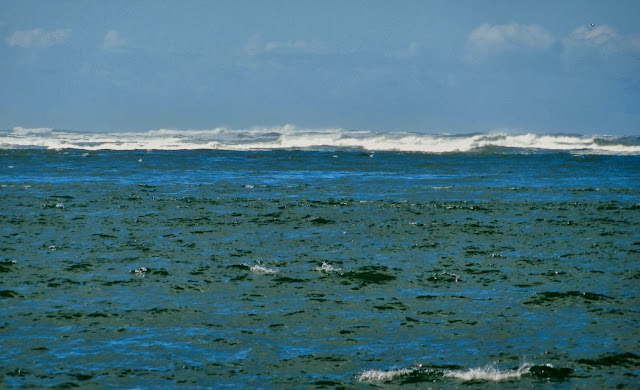
A Nice Day along the Pacific West Coast
When sailing between Seattle and San Diego, a Seattle departure date of mid-May would be the earliest safe bet.  The seas can still be lumpy along the Coast, but once you pass Point Conception just north of Santa Barbara, the seas are much calmer and change in color to a beautiful turquoise blue.  When returning to Seattle, you’ll want to be in the protected waters of Puget Sound by mid-September.  An Eye on the Weather:  Perhaps the most important aspect of coastal cruising is the ability to understand and interpret weather reports.  It’s imperative to consider the height of both wind waves and ocean swell, which should be combined in many instances for a true overall picture of the conditions at sea.  The number of seconds between ocean swells will determine the steepness of the waves and help determine if the conditions are acceptable for you and your boat.  For example, a wave height of 8 feet at 12 seconds apart brings a gentle rise and fall, verses a wave height of 8 feet at 5 seconds which produces an uncomfortable steep rise and fall.  Wind speeds, wind direction, and currents are also important factors when making a go, no-go decision.  The best advice is be patient and wait for the right weather window, but don’t hesitate to go when the opportunity arises.  Fortunately boaters have numerous resources to obtain current weather conditions including: 
www.wrh.noaa.gov; www.buoyweather.com; www.commandersweather.com; www.passageweather.com; www.saildocs.com; and www.sailflow.com.  These worldwide reports present weather at a macro level so keep in mind that localized winds can vary. 
Weather Buoy
While in Mexico, we discovered that Geary, a resident of Mexico, provides localized weather reports at
www.sonrisanet.org.  And don’t forget about the “cape effect” – when wind wraps around a major land mass or point jutting out into the sea.  We experienced both rough seas and calm seas around the many capes of California - once again it’s a matter of timing.  It can be helpful to get a second opinion or consultation over the phone from a weather service who assist boaters in interpreting weather charts and forecasts, such as Commanders Weather Service at 603-882-6789, available from 5am to 5pm Eastern Time (USA) 365 days a year.  Local Knowledge:  The Coast Guard provides frequent bar reports and it’s important for boaters to make contact prior to crossing a river bar.  In fact it’s one of the challenges of boating along the Oregon coast where ports are located inside the mouth of rivers.  During strong winds, the bars are often closed to boats under 40 feet and during severe storms closed to all recreational boats.  If a storm is brewing it’s wise to duck-in before bar restrictions are imposed.  
Coast Guard at Umpqua River Bar
Boaters should avoid crossing a river bar during an ebb tide, which produces steep dangerous surf.  While Oregon challenges the boater with its many river bars, Washington State presents a challenge due to its lack of coastal ports.  Grays Harbor is the only protected port along the Washington coast with nowhere else to go until you round Cape Flattery, the northern most point of the state.  Cruising at Night:  Being boaters from the Pacific Northwest, cruising at night was a new experience.  It seemed eerie at first, but once we got used to the idea, it was wonderful.  During a full moon we could see the horizon, and on other occasions we were in pitch black with a beautiful canopy of stars overhead.  Unlike Washington and Oregon, we didn’t have to worry about logs lying in wait along the coastline of California or Mexico.  Keeping clear of crab pots, however, is a constant challenge.  When running at night, we stayed further off shore to avoid crab pots which normally are placed between a water depth-line of 60 to 300 feet.  Coast Guard Inspections:  Boaters should be prepared to answer questions posed by the coast guard and to be boarded for inspections.  We were boarded twice in Oregon, once on our southbound trip and again a year later on our northbound trip.  We were also boarded twice in Mexico and have been boarded when passing from Canada to the United States.  The purpose of a coast guard inspection is three-fold:  to confirm boat registration papers, to inspect required safety equipment, and to look for any pollution infractions. 
Required Navigation Rules Publication
After showing our boat registration papers and the required copy of U.S. Coast Guard Navigation Rules, the coast guard boys inspected our fire-extinguishers, life-jackets, emergency flares, and operation of our horn and navigation lights.  A note regarding flares:  if you have old flares and new flares, the old flares should be kept in a separate bag marked “old, for practice only.”  All fire-extinguishers should have a current inspection date on the tag.  In addition to these required items, we also carry survival suits and a “ditch-bag” packed with water, food, and a locator-beacon.  Pollution prevention inspections include checking the bilge for any oil leaks and verification of a waste-treatment system or holding tank.  Warning placards for no-dumping of oil and garbage are also required along with a posted trash collection plan and person responsible for the task.  Once the coast guard has completed their inspection, a copy of the report is given to the boat owner, good for one year without further inspections during the year.  Of course, any infractions must be corrected before the next inspection.  The Rewards:  The satisfaction of having made such a journey is a real rush.  Knowing you met the challenge, that you were fully prepared, and returned safely without assistance is a test and true measure of self-sufficiency.  On a related political note, determination, success, and self-sufficiency seem to be seriously lacking in today’s society and these traits are now considered out of vogue. 
One With Nature - Two Whales Passingby
Boater’s on-the-other-hand keep sailing on, setting goals and creating their own successes knowing that others can’t do that for them.  We have met many of these like-minded people through the boating community and have made new life-long friends.  It’s always a pleasure to be around those who inspire and encourage others to take the next step, one of life’s sweetest rewards.  The experience of witnessing nature in action was also an inspiration, finding ourselves among creatures of the sea, land, and air.  It was an ever present reminder of the beauty all around us, and how we too are part of this wondrous world.


Saturday, September 28, 2013

The Home Stretch


Celebration at Point Hudson Cafe
Today the wind is howling and the rain blowing sideways as we sit cozy, comfy aboard Got d’ Fever in Seattle at Elliott Bay Marina.  After rounding Cape Flattery, we decided not to stop at Neah Bay or Port Angeles on the Strait of Juan de Fuca.  We knew a strong storm front would reach the area by the weekend so we continued to Port Townsend located in northwest Puget Sound, arriving around 5pm - a 30-hour journey from Astoria.  To celebrate our accomplishment and safe arrival, we went out to dinner at Hudson Point CafĂ© next to the marina – a chance to relax and reflect.  Even Java sensed the excitement and seemed jubilant to be back in familiar waters.  The following morning we were off again, heading south for Seattle.  The beginnings of the storm were soon upon us with 20-25 knot winds which created choppy wind waves; but of course without any added ocean swell – oh, this is nothing we thought, we’ve seen worse!  The phrase from the Truman Show movie came to mind, “is that all you got?” 


Point No Point Lighthouse - Hansville
The winds then picked up to 33 knots around the north tip of Kitsap Peninsula at the Point No Point Lighthouse as we passed Hansville, Washington.  Continuing south, we kept to the far side of the shipping lanes to avoid those fast moving cargo ships and kept an eye out for ferries on their regular runs.  
Discovery Park Lighthouse - Seattle
As we rounded Discovery Park Lighthouse, Seattle came into view shrouded in clouds, home at last.  We pulled into our assigned slip at 2:30pm on September 27th with the wind blowing, lashed down Got d’ Fever, and set up housekeeping as if we had never left.  
Arriving into Seattle
Out of nagging curiosity we checked on the coastal weather conditions:  25-40 knot winds with gusts to 55 knots, ocean swells from 21-23 feet and building! A sobering thought, we had avoided the approach of a gale-force storm!

Thursday, September 26, 2013

Small Window, Big Hurtle!


Clatsop Spit- shallow portion of Columbia River Bar
Our last leg up the West Coast presented a number of challenges regarding timing.  Indeed, many boaters coming up the coast late in the year have found themselves held up by weather in Astoria, Oregon.  It is critical to avoid the Columbia River Bar during an ebb tide and to choose conditions at sea when the combined wind waves and ocean swells are manageable.  Additionally, Grays Harbor is the only escape along the Washington coast with nowhere else to go until you round Cape Flattery, the northwestern most point of the continental United States.  We departed Astoria at noon on September 25th, reaching the Columbia River Bar around 1pm for the end of an ebb tide; as it was we still encountered 8 foot ocean swells over the bar. 


North Head Lighthouse - Columbia River Bar
Once outside the bar we faced 9-10 foot swells at 8-9 seconds apart, manageable for Got d’ Fever.  Upon reaching deeper water the swells subsided to 6-8 feet at 11 seconds, but we would soon have to turn north with the waves hitting us abeam.  Because the ocean swell came at longer spaced intervals, they passed underneath us with little roll effect.  Winds were moderate, averaging only 10 knots but created surprisingly choppy wind waves and a lumpy ride for the entire night.  The moon appeared around 11pm and gave us enough light to see the horizon and sea conditions but neither one of us could sleep.  Java napped as best she could while bracing her paw against our lap.  After what seemed like a very long night, we neared Cape Flattery around 5am; the moon had departed and we found ourselves in the dark.  
Looking back at Cape Flattery
We reduced our speed and brought out the 1,000 watt flood-light which Leonard attached to the bow of the boat in hopes that we would be able to see logs ahead – rumble, rumble; a log passed under the boat but with no apparent damage done.  Dawn came an hour later with winds still averaging 10 knots and swells at 7 feet, 11 seconds.  
Sunrise - Strait of Juan de Fuca
By 6:40am we had rounded Cape Flattery and the sun rose over the Strait of Juan de Fuca, we had made it!  
Ah, Green Hills Again - Strait of Juan de Fuca
And Snow Peaked Mountains
Once inside the Strait, the waters were calm and we soaked in the beauty of the snow peaked mountains, green hills, and forested landscape.  The sun felt warm against the cool, crisp air – ah, now this is boating.


Calm Waters of Puget Sound 

Tuesday, September 24, 2013

Boat Insurance, a Key Ingredient


As we near the culmination of our journey up the West Coast, I must give some much deserved accolades to our insurance representative, Joe Cable of Mariners General Insurance Group in Seattle.  He has been an integral partner in making sure we have the appropriate insurance for our boat.  Most boaters are familiar with the need for general insurance coverage including liability, property damage, bodily injury, theft, towing, and Federal pollution limits; but some boaters may not be aware of "trip plan" coverage.  While it’s not a good idea to scrimp on insurance, an astute agent can help boaters save money by providing coverage based on specific cruising regions.  Joe Cable's experience with boat insurance has been invaluable to us during our cruising adventures to different locals.  Instead of providing "go-anywhere-at-any-time coverage," he has helped us cruise more cost-effectively by finding appropriate coverage for a specific area and time of year at a more reasonable price.  We have appreciated his responsiveness to our needs and change of plans during our journey up and down the West Coast.  He understands that boaters are wanderers who love to discover new regions; he has kept abreast of our insurance needs, responding in a timely manner to all our communications.  Thanks Joe!  Specific insurance often required by other countries, such as Mexico, can also be arranged by Mariners General Insurance Group.    


Sunday, September 22, 2013

Boats, Planes, and Automobiles


While waiting for some bad weather to pass, namely gale-force winds hammering the Pacific Northwest, we decided to make use of our time and pick up our car which we had left in San Francisco.  We drove a rental car from Astoria to Portland where I dropped Leonard off at the Airport for his flight to San Francisco to retrieve our car.  Java and I stayed at my mother’s home while Leonard began the arduous drive back to Portland, a 12 hour trip requiring several stops for some rest and sleep – he arrived the following morning at 8am.  He had encountered strong wind and rain, making visibility difficult at times, as did my mother and I when we drove back from shopping. 


A Weekend of Heavy Rain and Strong Winds
A heavy downpour of rain left standing water on the freeway sending spray over the windshield and above the sides of the car – were we in a boat, or in a car!?  After Leonard arrived in Portland, we drove back to Astoria anxious to check on our boat – had we added enough lines and fenders? Did the boat sustain any damage at the dock?  We hurried to the boat slip and found that all was well with Got d’ Fever despite the strong wind that had passed through the area as reported by our neighbor on Castaway, a fishing boat.  He had also noted that the Columbia River Bar was closed in addition to all the other river bars along the Oregon coast due to 55 mile an hour winds.  It will take a while for the seas to settle down, but we are hopeful a weather window will open up later this week so we can begin our journey by sea up the Washington coast.

Thursday, September 19, 2013

Another Day, Another Night


A Beautiful Evening
After arriving at Salmon Bay Marina, we spent the afternoon resting up and then headed out again at 5:30pm to use up the remainder of a weather window.  Eight-to ten foot swells were running along the edge of the Umpqua River Bar; once outside the bar we had relatively calm seas, which turned into smooth, gentle rollers later that evening. 


A Moonlit Night with Artistic Clouds along the Coast
It was a pleasant cruise with several whale sightings, accompanied by their haunting sounds.  Best of all, it was a moonlit evening so we could see the horizon and the direction of the waves throughout the night.  The following day brought lumpy seas and 5-foot swells with winds shifting from the northwest around to the southeast.  We arrived at the Columbia River Bar at 1:40pm that afternoon – time to make an important decision.  Should we continue motoring another 158 nautical miles along the Washington coast to Neah Bay (a run of 21 hours), or should we stop at Astoria?  Several factors affected our decision:  1) a gale-force wind was approaching the Washington coast and would arrive at 5pm that following day – what if it arrived earlier and/or we arrived later, not a pretty picture  2) it also seemed a bad idea to be motoring in the dark along the Washington coast due to logs, deadheads, and other debris in the water that could damage the hull of the boat or damage the props, likewise not a pretty picture.  
A Fishing Boat Entering the Columbia Bar
 
At the same time, however, we might be missing our last weather window to get back home and end up spending the winter in Astoria, or cruising up the Columbia River to winter over in Portland, Oregon – not necessarily an unpleasant prospect.  
Coast Guard Boys Practicing - Columbia River
Rather be safe than sorry was the decision; we had been beaten up enough so we headed over the Columbia River Bar into Astoria.  
Got d' Fever Approaching Astoria
After pulling into our assigned slip at Astoria Mooring Basin, we settled in for the night, happy to sleep in a real bed after spending several nights in the pilothouse bunk.  We woke up the next morning to find that a cruise ship (the Norwegian Sun) had come into port for the day, an opportunity for its passengers to enjoy this charming and historic town.

Tanker Traffic passing Got d' Fever - Astoria
Got d' Fever at Astoria Mooring Basin
Cruise Ship at Astoria

Tuesday, September 17, 2013

The Calm before the Storm


Umpqua River Bar

Umpqua River Bar
After a quick “pit stop” at Brookings for fuel, we continued northward in 2-foot chop and gentle 5 foot ocean swells.  We were making good time cruising most of the way at 8 knots.  Around 8pm that evening, Leonard noted that the starboard sea strainer needed to be cleaned out.  While the seas were still relatively calm, we shut down the starboard engine.  I motored along using the port engine while Leonard went below and cleaned out the strainer – a quick 20 minute job and we were up and running again with two engines.  We passed Cape Blanco at 11pm in the fog and by 4am we had passed Coos Bay.  Suddenly, the seas became choppy; it was now 6am and we noticed two huge blobs on our radar screen - rain squalls were passing through the area!  The squall kicked up the sea something fierce so we headed for Salmon Bay Harbor where we would first need to get safely across the Umpqua River Bar.  We radioed for bar conditions and were told it was still open.  Then we heard on the radio that it had been closed so we changed course and headed for Coos Bay.  Shortly thereafter, more information about bar conditions and restrictions were reported over the radio and we learned that vessels over 40 feet could still come across the Umpqua River bar, reported to have 8-10 foot breaking waves.  Once again, we changed course while negotiating the steep seas.  Other boats were also trying to make their way into a safe harbor – we heard a sailboat asking for help to negotiate the bar at Coos Bay while we were making our approach to the Umpqua River Bar.  Typically the steeper waves at the Umpqua Bar are on the left side as you are coming in, so boat traffic tends to stay on one side of the channel, both coming and going.  As we entered over the bar there were several small fishing boats hanging out in the traffic lane and one very large fishing boat was coming out intersecting our path – oh great, that’s all we need, I murmured.  We made our way over the breakers and through the maze of boats just as the Coast Guard Tower contacted us by radio.  They wanted to know which port we had last visited and when we were last boarded.  Sure enough, as we came into the transient guest dock to tie up, there were two Coast Guard boys ready and waiting to inspect our boat – oh brother, I just want to sleep!  After reviewing our safety equipment and paperwork, we received a copy of the inspection form which is good for one year with no more inspections!  By then it was 10:30am, time for bed!

Monday, September 16, 2013

Keep Moving!


Calm Seas - now that's more like it!
After spending two nights at Bodega Bay, “Pacifico” seemed to be in a better mood and offered up calm seas for our early 6am departure.  We were greeted with light winds that continued through the day, including our traverse around Point Arena.  In order to take advantage of the good weather window, we continued motoring through the night. 


Arena Lighthouse
As we neared Cape Mendocino at 10:30 that evening, the seas became choppy.  This notorious cape is actually made up of several capes or points:  Cape Vizcaino, Point Delgada, Punta Gorda, Cape Mendocino, and False Cape - it took us about three hours to get around this large land mass jetting out towards the sea.  Strong wind and current, known as the “cape effect,” often create rough conditions for mariners.  Fortunately, we encountered only 22 knot winds and moderate chop, not considered extreme conditions for Cape Mendocino.
Sunset Welcomes the Night
Leonard and I shared helm watch through the night and slept off and on.  While Leonard was on watch we passed Eureka in the wee hours of the morning, suddenly the auto pilot dropped out and returned to “standby” mode (manual steering required).  The alarm hadn’t sounded so Leonard didn’t notice it until he looked at the chart plotter indicating that the boat was heading directly for land; “what’s going on? oops!”  He soon realized what had happened, got back on course, and re-engaged the auto pilot.  Then it was my turn to come on watch and I immediately noticed that a sailboat was directly ahead of our path about a mile out and approaching in the opposite direction.  Yes, it was time to take evasive action while Leonard caught up on some much needed sleep.  The dawn broke and gentle sea swells rolled under Got d’ Fever; it was the start of a new day.  Once again the seas were calm and we saw several whales making their north-south ocean voyage. 
Coast Guard on Patrol
Commercial Shrimping
Two fishing vessels could be seen in the distance trawling for their catch.  Over the radio we could hear the Coast Guard asking the captain of each fishing vessel what type of fish they were hauling.  Soon the Coast Guard Cutter headed our way and we too were contacted by radio, “what is your purpose and destination” they asked, “and when were you last boarded?”  We didn’t mind the questions; it’s nice to know that the Coast Guard boys are around!  
Commercial Fishing
We continued our journey northward, bypassing Crescent City and the historic Saint George Reef Lighthouse.  We reached Brookings, Oregon around 3pm and after a quick pit-stop for fuel, we were off again for another overnighter - “keep moving when the weather is good!” 
Saint George Lighthouse

Saturday, September 14, 2013

Changing Course


Boaters are often flexible regarding their choice of destinations and play things by ear depending on their wish list and or changing life styles.  For us, “changing course” has a double meaning.  After taking another trip by car to Seattle, we decided that it’s time to let go of a house we no longer need.  Yes, we are putting our home on the market around the first of March and have begun the process of completing projects in preparation for this change.  We also decided to motor the boat north to Seattle rather than make frequent car trips back home to work on the house.  Motoring up the West Coast this time of year, however, can be very challenging.  We left San Francisco on September 13th heading for Bodega Bay just north of the notorious Point Reyes.  We encountered winds ranging from 15 knots to 35 knots which we have negotiated in the past, but the waves were close together and steep, more so than anticipated.  


ZigZag Path (right dark blue line)
It was the first time we’ve had to travel in a zigzag course to safely negotiate the steep waves and we were still being knocked around.  Water was splashing up over the pilothouse windows so frequently that water seeped through the pilothouse doors.  It felt as if Got d' Fever was falling down the front side of the 8-9 foot steep sea cliffs.  One wave threw me across the room and I fell on my “A Double S” – good thing I have some padding!  Java had the advantage with this one due to her low center of gravity and four legs.  What was to be a 5-hour trip turned into a 6-hour trip due to our zigzag course; we made it into Bodega Bay with the wind still howling and found a side-tie for the night.  We were glad to be past one of the worst Points on the West Coast.  Weather for the next couple of days should be much better enabling us to make further progress northward.

Monday, September 2, 2013

The Palace of Fine Arts


Colonnades and Rotunda - Palace of Fine arts
Over Labor Day Weekend we visited the Palace of Fine arts located in the Marina District of San Francisco.  This monumental structure was built for the 1915 Panama-Pacific Exposition to display works of art.  Built next to a small lagoon, the Palace is composed of colonnades and a central rotunda. 


Colonnades along the Lagoon
The lagoon fronting the Palace of Fine Arts was a feature of San Francisco’s early landscape, part of a slough on a tidal wetland.  At the time of the Panama-Pacific International Exposition this slough, cut off from the tidal flow, had become a freshwater lake reduced to the size of a city block.  When Bernard Maybeck was appointed to design the Palace of Fine Arts, Maybeck incorporated the natural beauty of the site into his design, echoing that found in classical European settings. 

The Palace was so beloved that a Palace Preservation League, founded by Phoebe-Apperson Hearst, was formed while the fair was still in progress.  Most of the buildings were demolished after the Exposition, but the Palace had been saved thanks to the preservation league.  Originally intended to only stand for the duration of the Exhibition, the colonnades and rotunda were made from wood covered with staff, a mixture of plaster and burlap-type fiber.  
Beautiful Detail
By the 1950’s the structures had dramatically deteriorated.  In 1959 philanthropist Walter Johnson spearheaded an effort to raise preservation funds and donated four million dollars.  The structures were stripped to their foundations and a permanent version of Maybeck’s design was reconstructed in steel and concrete with details cast from the original.  
A Peaceful, Inspiring Setting

The only changes were the absence of the murals in the dome, two end pylons of the colonnades, and the original ornamentation of the exhibit hall.  Exterior lighting was added in the late 1980’s for the rotunda and colonnades, creating a lovely ambiance at night.  San Francisco once again rallied to save its Palace in 2003, when the Maybeck Foundation partnered with the City of San Francisco to raise 21 million dollars for significant seismic upgrades, which were completed in 2009.  
The Rotunda
The Rotunda
A
n awe inspiring classic beauty and lovely retreat for city dwellers, the Palace of Fine Arts is indeed worth preserving.  In addition to hosting art exhibitions, theatre productions, and special events, it remains a popular attraction for tourists and locals alike. 


Sunday, September 1, 2013

Presidio of San Francisco


Golden Gate seen from The Presidio
 
Today we visited the Presidio of San Francisco.  The Presidio (originally, El Presidio Real de San Francisco (the Royal Fortress of Saint Francis) is a 1,491 acre public park and former military base located on property at the southern end of the Golden Gate Bridge.  The Presidio has a military history dating back to 1776 when a 63-man expedition of Spanish soldiers, priests, and settlers arrived to establish a presidio under the authority of Spain in answer to English and Russian interests.  Father Junipero Serra established a mission nearby, calling it San Francisco de Asis, later known as Mission Dolores.  Authorities in Spain were not happy when they heard that English Captain George Vancouver had visited the Presidio in 1792, fearful that he would divulge crucial information about the Presidio. 


Golden Gate and Battery Emplacement (left)
The Presidio later passed to Mexico following their independence in 1821 and was subsequently seized by the United States Military in 1846 at the start of the Mexican-American War.  This U.S military post officially opened in 1848 and became home to numerous Army headquarters.  Several famous U.S. generals such as William Sherman, George Henry Thomas, and John Pershing made their home here.  
WWII Battery Emplacement - Presidio of San Francisco
Fort Winfield Scott
The Park includes the military post of Fort Winfield Scott, completed in 1915, which defended the Bay Area for 40 years.  Most of the buildings were constructed in the Spanish Colonial or Mission Rival Style.  The fort included an infirmary, barracks, parade grounds, a stockade, workshops, storehouses, and recreational facilities.  There are 768 historic buildings and structures that remain in the Park plus huge coastal batteries overlooking the ocean.  
Fort Winfield Scott and the Golden Gate
Officers Row - Fort Winfield Scott
The Presidio acted as the nerve center for Army operations during WWII in defense of Western United States.  The Letterman Hospital was one of the Army’s busiest medical centers with a peak load of 72,000 patients in one year.  The complex now serves as the Thoreau Center for Sustainability, housing non-profit organizations.  As part of a 1989 military reduction program, Congress voted to end the Presidio’s status as an active military installation.  On October 1, 1994, it was transferred to the National Park Service ending 219 years of military use.  The park is characterized by many wooded areas, hills, and scenic vistas overlooking the Golden Gate Bridge, San Francisco Bay, and the Pacific Ocean.  Living quarters once occupied by officers and service men are leased as homes while other buildings are used for museums, park services, private schools, business organizations, and special events.


Presidio Housing overlooking the City

The Letterman Hospital - old main building