Monday, June 25, 2012

Red, White, and Blue


Gateway to a Shimmering City of White
Stupendous View from the Marin Headlands
We wanted to spend some time with family and friends back home so we rented a car in Sausalito for a day's drive to Portland and then on to Seattle the following day.  Before leaving San Francisco, we drove out to the Marin 
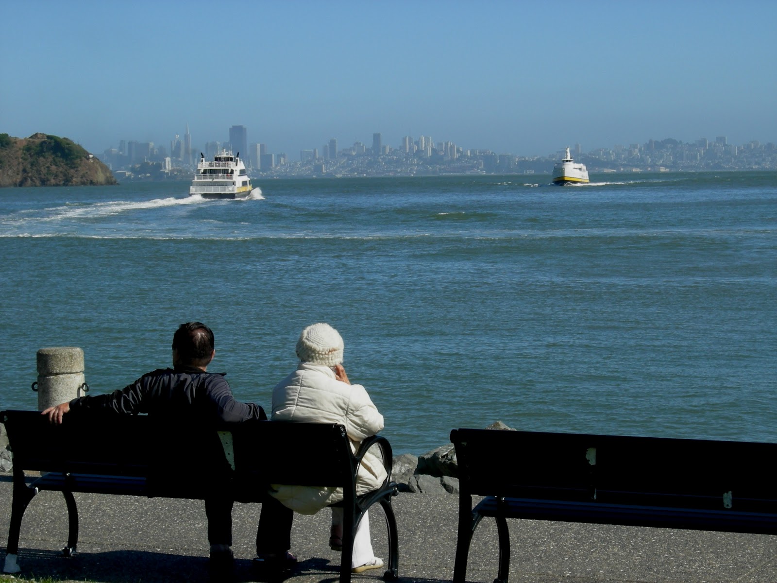
Headlands on the north side of the Golden Gate Bridge.  What a perfect day!  So often clouds blow in from the ocean and shroud “The City” with a blanket of gray.  We were thankful for the blue sky and stupendous views of the Golden Gate Bridge, Alcatraz Island, and the shimmering City Skyline.  From atop the Headlands we could see The City and its suburbs dressed in white, sandwiched between blue water and sky; the red bridge and majestic mountains stand like a mighty gateway.  Interestingly, San Francisco Bay was first sighted by the Spanish explorer Gaspar de Portola from the summit of the 1,200 foot Sweeney Ridge but he hadn't realized what he had found.  The first European to actually enter the Bay was Spanish explorer Juan de Ayala who arrived in 1775 on his ship the San Carlos and moored in a bay of Angel Island now known as Ayala Cove.  After stopping to take in the wonderful views, we continued our drive through the Marin Headlands out to Point Bonita Lighthouse.  As one might guess, the surrounding hillsides that make up the Headlands are peppered with old battery emplacements; and several Army camps, that once protected this important harbor, can still be seen near the entrance of the Bay.  The Bonita Lighthouse has stood watch over this gateway for more than 150 years.  Visiting the lighthouse is definitely a fun adventure, reached by hiking a trail out to Bonita Point then walking through a tunnel in the rock face and over a suspended foot bridge to the lighthouse perched on a rock pinnacle.  As we walked across the foot bridge looking down at the sea 300 feet below, the bridge began to bounce up and down.  Leonard, uncomfortable with heights, quickly made his way across, but I had to stop and take some pictures.  This unique lighthouse was the third lighthouse on the West Coast, completed in 1855 with a second-order Fresnel lens.  The Fresnel lens system was developed in 1822 by French physicist Augustin Fresnel; the system works with ground glass prisms arranged in rings around a light source.  Fresnel’s invention bends seventy percent of the outgoing bulb light and focuses it horizontally.  There are seven types of lenses or “orders” each different in size.  Navigators can distinguish one lighthouse from another because each lighthouse has its own pattern of light.  Point Bonita’s light switches on for three seconds, off for one.  In dense fog when the light signal cannot be seen, a sound system is activated.  Fog horns are as distinctive as light signals.  Point Bonita sends out two blasts every 30 seconds.  Most boaters today use electronic charts for navigation but lighthouses still serve as visual landmarks and aids to navigation.  We  look forward to being back on the boat and seeing many more sights in San Francisco upon our return from Seattle.
Bonita Point Lighthouse
Suspended Foot Bridge to Point Bonita Lighthouse
Cables Holding the Foot Bridge in Place
Cables Securely Anchored
A Long Way Down

Friday, June 22, 2012

Angel Island’s Military History


Abandoned Fort McDowell - Angel Island
Fort McDowell Barracks and Mess Hall
Fort McDowell Officers Row
Battery Drew - Angel Island
Nike Missile Period
After visiting the Immigration Center on Angel Island, we continued our walk around the Island’s perimeter road – next stop, Fort McDowell.  Fort McDowell began as a detention camp in 1898 for soldiers returning from the Spanish-American War.  In 1910 and 1911, Fort McDowell was expanded into a major facility for receiving recruits and processing military personnel for overseas assignments.  Construction included a huge 600-man barracks, a mess hall, and a hospital.  It was a busy camp during WWI with four thousand men per month passing through Fort McDowell on Angel Island.  When WWII began, Fort McDowell was one of three sites in the San Francisco Embarkation system; more than 300,000 soldiers were shipped to the Pacific from Fort McDowell alone.  When the War came to a close, military action began to diminish and the flag was lowered at Fort McDowell for the last time in August of 1946.  Today, Fort McDowell looks like a ghost town with numerous abandoned concrete buildings, missing windows, and empty play fields.  The houses along Officers Row, the Hospital, and the Chapel stand silent overlooking the compound.  Only a couple homes are occupied by Angel Island Park Staff. We continued our walk along the narrow road above the steep cliffs, reaching the south side of the Island with beautiful views of Alcatraz and the San Francisco Skyline.  We passed by the current Coast Guard Station and an old Nike Site.  Angel Island was one of nineteen Missile Sites in the Bay Area from 1954-1961.  The Army dismantled the installation in 1962 but we could still see three notches in the hillside that were made to improve the line of sight with a radar control station placed on Angel Island’s Mt. Livermore.  As we approached the southwest side of the Island, we came upon three Endicott Battery emplacements.  Battery Drew was the first Endicott Battery on Angel Island built in 1898, construction began just three weeks before the start of the Spanish-American War.  The construction of two additional batteries soon followed; one was built on the site of the old Point Knox Civil War battery.  Rounding the Island to the west, we stopped to visit Camp Reynolds.  Camp Reynolds was established in 1863 due to the mounting threats to the Bay Area from Confederate sympathizers and the concern of possible naval attacks.  After the Civil War, Camp Reynolds became an infantry camp for recruits and a staging area for campaigns against the Apache, Sioux, Modoc, and other Indian tribes.  There were over 200 soldiers by 1876 and a complete camp including a chapel, bakery, blacksmith, shoemaker, laundry, barber, trading store, and a resident photographer in addition to barracks, officers quarters, and a large warehouse.  Today the windows of the chapel and officers quarters are boarded up, looking like ghosts from the past.  The enlisted men’s barracks were taken down by the Army in the 1930’s.  Fortunately, the Warehouse and Bakery are open to the public and the Commanders house serves as the Visitor Center for Camp Reynolds.  We left the Camp still frozen in time and continued our walk north, arriving back at Ayala Cove where we had started our historic tour of Angel Island.  It was nearing dusk as we made our way across Richardson Bay to Sausalito, our dinghy rode over steep waves that were kicked up by the wind, a daily afternoon occurrence in San Francisco Bay.
Camp Reynolds Officers Row

Camp Reynolds Warehouse

Camp Reynolds Chapel

Angel Island – Immigration Center of the West

Angel Island (Horseshoe Bay in foreground)
Angel Island State Park - Ayala Cove
Historic Quarantine Station and Current Visitor Center - Ayala Cove 
Immigration Station Barracks - China Cove, Angel Island
Muli-tiered Bunks, Immigration Barracks - China Cove
Immigration Station - China Cove, Angel Island
We spent the day on Angel Island after motoring our dinghy across Richardson Bay from Sausalito. Angel Island State Park is located off the peninsula of Tiburon and is definitely a must see in the San Francisco Bay Area.  Not only did we find it a most beautiful island with wonderful views of the greater Bay Area, but also found it to be rich in history including its role as a U.S. Immigration Center.  We tied our dinghy to the guest dock in Ayala Cove and walked up to the Quarantine Station (1891-1946) office building, which now houses the Angel Island Visitor Center & Museum.  The Quarantine Station was established to isolate people with contagious diseases and included more than 40 buildings, four of which remain today.  As years passed, use of quarantine stations diminished due to improved medical examinations and practices.  From Ayala Cove, we began our 9-mile walk around the Island stopping at the Immigration Center (1910-1940) in China Cove.  It was here that the Chinese immigrants arrived after their long journey at sea.  The center was designed to process Chinese immigrants whose entry was restricted by the Chinese Exclusion Law of 1882 and included a hospital, administration building, housing for employees, and barracks for detained immigrants.  Japanese and Europeans were also processed through this center but more than 97 percent of the immigrants processed on Angel Island were Chinese.  For 30 years, this was the point of entry for most of the approximately 175,000 Chinese immigrants who came to the United States.  An economic downturn in the late 1800’s resulted in serious unemployment problems and led to outcries against Asian immigrants who worked for cheap wages.  Restrictive immigration laws allowed entry only to those Chinese that had been born in the U.S. or had husbands or fathers who were already citizens.  As a result, these “fathers” would sell papers to other Chinese identifying them as a wife or child.  Immigration officers asked tough questions; and if detainee’s answers did not match the “father’s,” he or she could be ordered deported so “fathers” began including a list of questions and answers for immigrants to memorize before their arrival.  For most nationalities, the stay on Angel Island typically lasted two to three days.  The Chinese Exclusion Act, however, resulted in intense interrogation and an appeal process that took weeks, and in some cases, up to two years.  Living conditions at the barracks were crowded, ventilation was poor, and the restrooms were filthy.  Rows of multi-tiered bunks filled the barracks providing little to no privacy.  The compound was enclosed with a barbed-wire fence and guarded by two gun towers.  The Chinese naturally lamented their fate and expressed their hopes and emotions through poetry carved into the walls of the barracks; many of these carvings are still seen on the walls today.  After the administration building burned in 1940, the Station was closed and all immigrants were moved to San Francisco.  The so-called “Chinese Exclusion acts” were eventually repealed.  The buildings remaining on Angel Island were taken over by the Army during World War II to house German, Japanese, and Italian POWs in the barracks.  These prisoners also left to posterity their writings on the walls.
Chinese Poem on Walls of Barracks - China Cove
Hospital Viewed Through Barrack Windows - China Cove
Site of Wharf at Immigration Station - China Cove

Tuesday, June 19, 2012

A Bike Trip – Sausalito to Tiburon


Sausalito Houseboats
Mid-1800's Lyford Mansion
Bike Ride to Tiburon
The warm weather and gentle breeze in Richardson Bay seemed the perfect opportunity to go on a bike ride.  We rode our bikes along a dedicated bike path from Sausalito to the other side of Richardson Bay to visit the communities of Tiburon and Belvedere.  As we headed north out of Sausalito, we passed numerous houseboats similar to those in Seattle.  One group of houseboats however looked like the “low-rent district;” apparently not everyone in Sausalito has money!  As we made our way around the bay and up a hillside, we came upon a historic Victorian home overlooking the bay.  The Mansion was built in 1867 by Benjamin Lyford and Hilarita Reed Lyford and is listed on the National Register of Historic Places.  John Reed, the father of Hilarita, received Marin County’s first Spanish land grant.  John Reed’s 1834 land grant of the Rancho Corte Madera del Presidio comprised the peninsula incorporating today’s Tiburon, Belvedere, and much of southern Marin County.  Land grants were common practice in the early 1800’s.  The Spanish and later the Mexican government encouraged settlement of the territory now known as California by establishing large land grants with grazing rights called ranchos.  Rancho boundaries became the basis for California’s land survey system and can still be found on modern maps and land titles.  The Lyford home was originally located at Strawberry Point at the end of the bay and was moved in 1957 when threatened with demolition.  The house and property is managed by the Richardson Bay Audubon Society & Sanctuary, offering educational classes for children and adults.  After our brief stop, we continued down the hillside and around the bay enjoying the beautiful views of Tiburon and the San Francisco skyline in full view from the bike path.  Tiburon and Belvedere are posh communities with mansions built on the hillsides and along the waterfront; a foot ferry runs between Tiburon and San Francisco and is quite popular among bicyclists.  Tiburon was formerly the southern terminus of the Northwestern Pacific Railroad which carried lumber to the town and then shipped to cities around San Francisco Bay.  In 1884 Peter Donahue, a San Francisco industrialist, extended his railroad to Tiburon and provided ferry service thus creating a railroad town on the Mexican land grant held by Hilarita Reed Lyford.  The Depot, now a museum, was preserved and is located near the present day ferry landing; the former railroad right of way now forms the multi-use bike path.  After a short rest and a fruit smoothie, it was time to head back.  By the time we arrived home at the boat, we had biked 18-20 miles on our little fold-up bicycles – our bums were sore and our legs were tired, we definitely had a good workout!
Belvedere at Tiburon
A couple watching the Ferries at Tiburon
The Donahue Depot

Monday, June 18, 2012

Savoring Sausalito


Sausalito
Town Square - Sausalito
Bay-Delta Model Education Center
We spent a couple of days touring Sausalito and found that it reminded us of Kirkland, an enclave of boutiques, cafes, and art shops situated along a pretty waterfront with the addition of Palm Trees.  Although Sausalito has a relatively small population, it draws both locals and tourists from the greater Bay Area.  The sidewalks were bustling with people and we sometimes felt like fish swimming upstream.  We walked back towards our marina and stopped to visit the interesting “San Francisco Bay-Delta Model” - a three-dimensional model representing the San Francisco Bay and Sacramento / San Joaquin River Delta System, which simulates tides, currents, and river flows.  The working hydraulic Model covers over 1.5 acres and was built in 1957 by the Corps of Engineers for the purpose of scientific research to evaluate flow characteristics of the water within the estuary and to make assessments regarding the impact of man’s activities.  The Model was opened to the public when it became an education center in 2001.  We found it to be quite impressive, made up of 286 concrete slabs that rest on adjustable jacks.  Pumps circulate more than 100,000 gallons of water through the Model to simulate tides and currents, while embedded copper strips permit adjustment of frictional resistance.  Viewing the Model really helped us grasp the enormity and complexity of the Bay Area waterways – its rivers, streams, channels, coves, canals, and bays that create the largest estuary on the West Coast.  The Bay Area estuary drains approximately 40 percent of California water flowing in the Sacramento and San Joaquin Rivers from the Sierra Mountains, depositing sediment in the Bay.  The average water depth in San Francisco Bay is only 12-15 feet with the deepest part under the Golden Gate Bridge.  The Corps of Engineers maintains frequent dredging in San Francisco Bay and its two major rivers, creating underwater channels for cargo ships and large pleasure boats to follow.  Of course being boaters from the Pacific Northwest, this seems quite confining compared to the deep open waters of Lake Washington, Puget Sound, and our Island paradise to the north.  The building that houses the Bay Model is also a treasure - it formally served as the warehouse for the "Marinship" Shipyards during WWII which built Liberty Ships and Oil Tankers, a small segment of the Education Center includes a history of the shipyards.

Painted Murals throughout the Bay Model Education Center
A Portion of the Bay Model - San Pablo Bay Area
Bay Model - a portion of the River Delta
Overview of the Bay Area Waterways

Saturday, June 16, 2012

Through the Golden Gate


Looking Back at Point Reyes and Pt. Reyes Lighthouse
Pt. Reyes Lighthouse
Pt. Bonita Lighthouse outside San Francisco Bay
We made our way down the long dredged channel over the mud flats of Bodega Harbor and out to sea in the early morning.  The weather buoy reported 8.9 foot swells every 9 seconds but we found only 3-5 foot swells with occasional 6 footers – this time around, the weather was better than predicted.  Of course we had not yet reached Pt. Reyes, the formidable obstacle for boaters headed to San Francisco.  Several boaters had told us, “If you can make it around Pt. Reyes, you’re home free.”  The headland of Pt. Reyes extends 10 miles out to sea and is the windiest place on the Pacific coast and the second foggiest place on the North American continent.  We had chosen a favorable weather window for rounding Pt. Reyes, 5-7 foot swells and minimal wind.  As we neared the Point, the clouds lifted and we could see the impressive Pt. Reyes Lighthouse (built in 1870) perched high above the sea on a rock ledge surrounded by steep rock cliffs.  Once we rounded the Headlands, the seas flattened and the sun shone brightly– a distinctive dividing line between cool and warm.  Wow! We could stand on the bow of our boat and feel a warm breeze rather than the face-biting cold wind of the north.  The mountainous coastline is beautiful and surprisingly sparsely populated.  We were still fifteen miles north of San Francisco when the Golden Gate came into view.  As we rounded Pt. Bonita Light, broad grins came across our faces and feelings of joy swept over us; we had accomplished a major milestone!  The impressive Golden Gate Bridge was just ahead, a gateway to an exciting modern city, warm weather, and protected harbors to explore.  Our arrival fell on a busy weekend with sailboats crisscrossing in front of us, adding to an already dramatic scene.  After passing under the Golden Gate, we turned north heading for Sausalito and the Clipper Yacht Harbor Marina.  It felt downright hot when I got out and tied the dock lines.  The fleece jacket and long-sleeved shirts were quickly replaced with real summer clothes!  We found a cute Italian bistro next to the marina, where we celebrate our arrival in San Francisco Bay.  What a nice change of pace to eat dinner outdoors in the warm evening air.
Approaching the Golden Gate Bridge
A Momment to Remember

Passing Under The Golden Gate
We're Through The Golden Gate!
Heading for Sausalito

Friday, June 15, 2012

The Birds


Village of Bodega Bay and Taylor Street
Birds Arriving at Dusk
Seagulls rule at Bodega Bay
We enjoyed our time in Bodega Bay with its pretty undulating barren hillsides and we were fascinated by the strange behavior of the birds.  Each evening, seagulls would begin to congregate along the finger piers next to our boat.  As the evening wore on, more and more birds arrived and by nightfall, dozens of seagulls were standing on the docks all facing the same direction.  The birds were gone by morning but would return each evening for their nightly ritual.  The following afternoon, we bicycled into the village of Bodega Bay and had lunch at the Tides Restaurant.  We found a picnic table overlooking the water and the birds started gathering around the wharf.  One bird hopped up on our table and looked directly in our face as if to say “give me some food or else.”  Perhaps these birds knew they had famous ancestors.  After all, Alfred Hitchcock chose Bodega Bay for the setting of his 1963 horror movie, “The Birds.”  One of the opening scenes in the movie shows actress Tippi Hedren driving into Bodega Bay on the winding scenic road above town, the scenery from Bay Hill Road appears much the same today.  The Tides Restaurant, which has since been rebuilt, was used for the gas station, cafĂ©, and boat dock scenes.  Many of the shots of children running from the Potter School House were made on Taylor Street in the village of Bodega Bay.  The school house, now a private residence, is located in the town of Bodega six miles to the southeast.  Hitchcock wanted a quiet fishing village, fog, and stark looking hills for his horror movie and Bodega Bay fit the bill.  After our own encounter with the birds, we decided to watch the movie that night while the birds huddled just outside our windows.  Tourists still come to see the birds both literally and figuratively speaking and Tippi Hedren still makes regular visits to Bodega Bay for autographs.  Bodega Bay indeed has lots of birds and is home to over a 100 species, including cormorants, pelicans, terns, egrets, willets, oystercatchers, and numerious other species of birds.  It’s been said that more rare birds have been spotted in Bodega Bay than in any other area in Sonoma County, making Bodega Bay a bird watcher's paradise.
Birds Gathering at the Wharf
Give me food or else!
Potter School House Residence